Lowgap - Mt. Airy Loop
click the drawer icon to navigate map
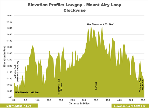
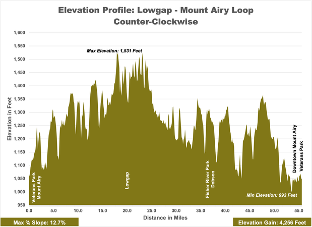
Lowgap - Mt. Airy Loop
Mount Airy, NC
55 miles
Advanced
Stats
1,531 ft.
993 ft.
4,421
4,256
13.2%
12.7%
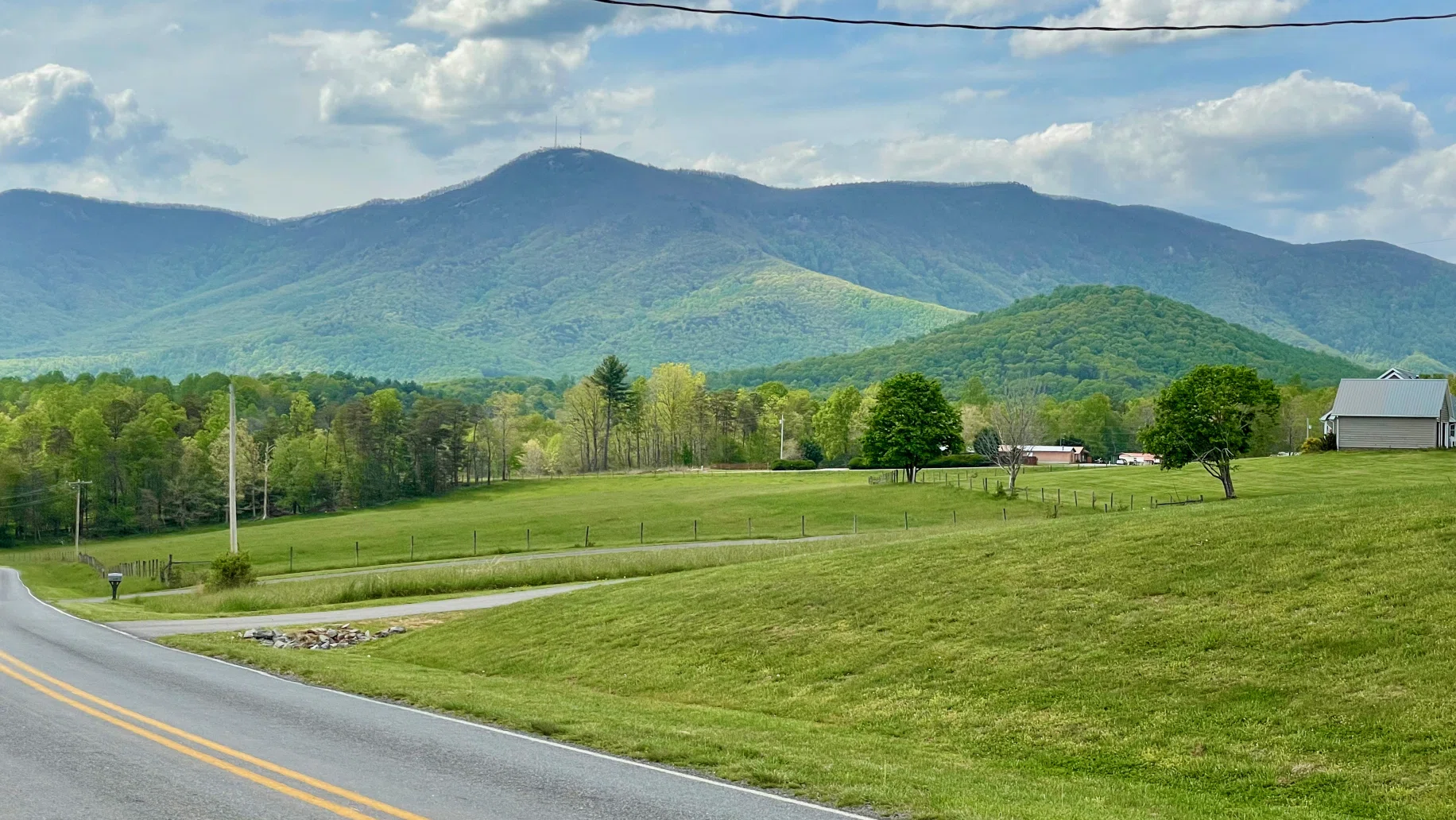
Within this route riders will experience big climbs and long down hills along the base of the Blue Ridge. Traveling through the northern end of the county you’ll see the historic Edwards-Franklin home along the Fisher River near Lowgap. Further north you can find your access onto the Blue Ridge Parkway and the Cumberland Knob Recreational Area, the highest point in Surry County. After cruising through the rural areas of the county riders will find themselves back in Mount Airy the counties largest city. Here you can stop at many different restaurants for a rest or explore the town at your own pace.
Connected Loops

Directions
Lowgap - Mt. Airy Loop - Directions - CWDirections
Lowgap - Mt. Airy Loop - Directions - CCWParking Recommendations
Veterans Park on Lebanon Street
Public Parking Downtown Mount Airy (Franklin Street/Dixie Street)
Provisions & Restroom
Points of Interest
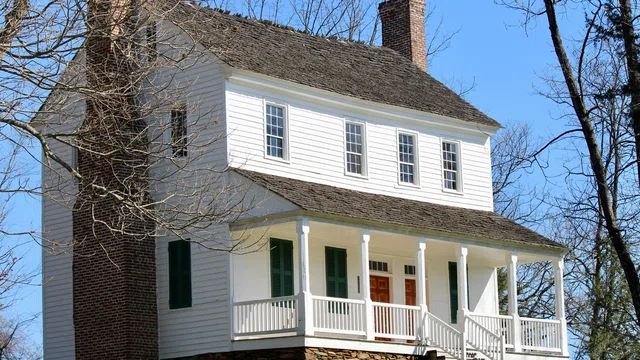
Edwards-Franklin House
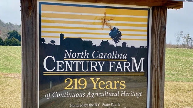
NC Century Farms

Fisher River Park
Stop Along the Way

Food & Drink
Winery
Mount Airy
Old North State Winery

Food & Drink
Restaurant
Mount Airy
The Loaded Goat
Food & Drink
Brewery
Mount Airy
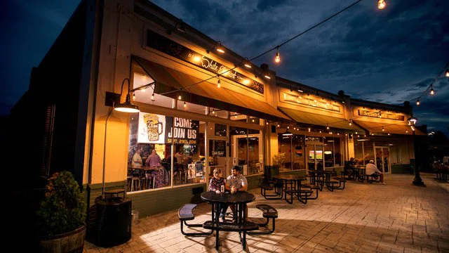
White Elephant Beer Company

Food & Drink
Restaurant
Lunch
Mount Airy
Barney's Cafe

Food & Drink
Restaurant
Lunch
Mount Airy
Leon's Burger Express

Food & Drink
Restaurant
Mount Airy
Soho Bar and Grill

Food & Drink
Restaurant
Brewery
Mount Airy
Thirsty Souls Brewery

Food & Drink
Restaurant
Lunch
Mount Airy
Snappy Lunch

Food & Drink
Spirits
Mount Airy
Mayberry Spirits Distillery
Looking for more?
Check out more Loops